St Swithun – Man and Legend

Man

There’d been one miracle in his life:
a woman dropped a basket of eggs
on the bridge that he built over the Itchen
and he collected the eggs – all unbroken.

Unlike his peers, the Bishops of Winchester,
he chose to be one with the soil and the wind,
buried in the churchyard, open
to the rain and the common people.

Pilgrims came – how they came
attracted by his space in the ordinary.
The pilgrims came and left like eggs,
arriving broken and leaving whole.

Other cathedrals wanted part of him.
Canterbury claimed the head.
Evreux an arm.
His fame spread as his body was broken.

At Winchester, Ethelwold reformed the monastery,
dedicated the cathedral church to him,
and built a shrine over him
where pilgrims could come and wonder.

Legend

Beneath the shrine, from rain protected,
St. Swithun woke, his heart dejected.
How he wept, how he cried.
For forty days, it rained outside.

ST. SWITHUN’S day, if thou dost rain,
For forty days it will remain ;
St. Swithun’s day, if thou be faire,
For forty days ’twill raine nae maire.

by Alastair Fear (written for share a poem on Saints and sinners – Nov 2023)

Day 9 – The Pilgrims Way

PiIgrims Way on Road
Today was a day out of sequence. I missed the Farnham to Guildford section earlier because of my knee injury. So today, I drove down to Farnham, very early. It was raining, and I left the car all day in a car park and started walking from the beginning of the North Down’s Walk. I followed the path alongside the River Wey, and then went on a road that crossed the River Wey by a stone bridge at Compton.

From there, the path entered the Runfold woods, which had been severely affected by the winds in 1987 and 1990. It’s no longer a Beechwood but has become more varied and is managed for wildlife. I emerged onto a road near a school. This road was long and straight for some miles, following the path of the original Pilgrim’s Way, while the North Downs Way followed footpaths.

There were separate footpaths along the road that alternated from one side to the other through to the village of Seale. I took a break and sat on a bench at a crossroads called Sandy Cross, looking north and east and west. There was not much traffic as I sipped water and ate a banana. There weren’t many people around either. Then, I carried on to the centre of Seale where I found a church.
Seale Church
I went around to the south porch and found that the door was open, allowing me access to the dark interior. There was a pilgrim stamp, which I used to fill the missing space I had left in my passport. Inside, I noticed a window dedicated to Anna and Simeon, two elderly people waiting for Jesus, which struck me as different, their wrinkled faces like mine.

As I left the church, the weather was improving. It had been raining when I began my journey. I had a lovely view across a field with some cows and up the hills towards the Hog’s Back. The war memorial had wooden crosses made dark by weathering, but the poppy wreathes remained red. I continued along the road, which wound left and right and lacked a separate footpath, so I had to cross sides several times. Most of the traffic was in a hurry which made it a bit challenging.

The surroundings woodland had orange bracken. At one point, I noticed a sign for the North Down Walk, but my path passed another Pilgrim Cottage, unique in it’s village but not along the Pilgrim’s Way. I reached Puttenham, where there were hop fields with poles. The hops had been harvested, and a few stragglers clung to poles.

I continued down a narrow street in Puttenham, which was constricted by ongoing roadworks. Along the way, I saw several straw figures as part of a scarecrow display. The pub was called “Good Intentions,” and featured a figure in puritan dress kneeling with a sword.

After that, I reached the church, which had a sign for an Alpha Course. The church itself was old, as my guidebook suggested, with a nave and an entrance dating back to early pilgrim days. The church was bright and well-lit, and there was a bookstore at the back. Outside I sat on a bench and ate my two oranges and looked at an old well and over rooftops, some of which had the vented hop chimneys. The village appeared in Brave New World by Aldous Huxley: ‘Puttenham was a modest little village nine stories high, with silos, a poultry farm, and a small vitamin-D factory.’
Crosses over Pilgrim's Way
I continued from there, and the path led through Puttenham Golf Course, where golfers were playing on either side. Signs for Tee Ten kept appearing until I passed Tee ten. The path went under a larger road, and then under a smaller road, with wood crosses on either side facing the Pilgrims Way.

Eventually, I came to another road at Compton, where I made a wrong turn, as I should have gone left towards Watts Art Gallery. Instead, I went straight across and found a narrow footpath that led to an area where young women were riding horses and practicing over horse jumps.

I realised I had made a mistake when I looked at Google Maps, so I retraced my steps and found the North Downs Way. I met a fellow walker who had come from London for the day and was doing a section of the North Downs Way. We walked together for about a mile, enjoying the sandy path, which was quite easy to walk on. He had an app that beeped if he strayed from the path.

At a junction, I had to continue straight on the road while my fellow walker followed the North Downs Way footpath to the left. My road went by a care home called Pilgrims Wood, and a Pilgrim’s Gardens, and another Pilgrims Cottage.
St Catherine's Chapel
The path then led me past the Surrey Police Headquarters and descended towards a road in Guildford. I crossed that road and continued on the path, and climbed a hillside to the ruins of a chapel called Saint Catherine’s Chapel. It is fenced off and mended in places with sharp edged modern stones.
Reflections in the River Wey
The path continued downhill to the River Wey, and I followed the riverway to central Guildford to catch my bus back to Farnham. There were beautiful reflections on the water of the far bank, with the sun behind me.

By mistake, I took the slow bus back to Farnham, with its 61 stops. It felt like another pilgrimage. The driver was one of the friendliest I had ever heard. He greeted everybody with ‘how are you today’, and then as people got off, he said, ‘Have a good rest of the day’ or later on, ‘have a good evening.’

Day 8 on the Pilgrims Way

The day began with a scramble up a bank to get to the footbridge over the A22 and re-join the way. Getting there had been quite difficult as I returned to Godstone and crossed the roads, making up the M25 and A22 roundabout. I’d seen a dead deer by the roadside. Then, there was no easy way up to the footbridge, so I ended up holding on to ivy and scrambled up the bank.

Today’s Pilgrim’s Way followed the North Downs Way (NDW) at first.

Early on, I came close to a large stag with antlers, that strode away and was gone.

After the way diverged from the NDW, I walked on enjoying the scenery but soon found the instructions no longer matched what I was seeing. I saw about twenty deer that all decided to run away together. I clambered through a fence and, using google maps, found that I could re-join the NDW up the road.

The Pilgrim’s Way and NDW went together for a mile or so, and climbed to a view across the M25 valley.

To rest my knee, I sat on a bench. Then looked for my water bottle but it was gone, probably during the scramble up the bank. I had nothing to drink. But there was a light rain. The path went down below a quarry, and then climbed up a chalk path running with water. I wasn’t going to die of thirst and knocked raindrops from haws and rosehips to get some water from finger tips to mouth. I tried a mouthful from a cattle trough – not a good idea because the water though clear had lots of leaves at the bottom. I even walked along with my mouth open to the rain.

The chalk path led to the highest point of the whole walk, round the enclosed Titsey Place and its park. Then the path left the NDW and went down beside a field with lots of pheasants who ran away or took flight as I approached.

The next stop was Titsey Church. I was quite lucky that it was open since it is only open a few hours a week and should not have been open in October. There were no books of any sort inside so it was not a used church. There were pews, a pulpit, and font, and stain glass windows. In a side chapel was a beautiful marble lady and a elderly bearded gentleman, one on either side, reclining . I signed the damp visitors book but could not see the writing of the Australian Pilgrim I usually saw ahead of me. I found the pilgrim’s stamp in the porch in a box and stamped my card. By now it was raining hard.

For the rest of the day’s walk to Westerham Hill, the Pilgrims Way followed a road called Pilgrim’s Lane. It had a little traffic, and I saw two horses, and a farm called Pilgrim’s Farm. It was also flooded in places so I walked though the water on my heels.

The first fields had lambs, and then after crossing a road there were vines. A tractor machine was harvesting the grapes. The lambs had been in Surrey and the vineyard in Kent.

I caught a bus back to Oxted and then returned home this evening. I will look for a clear run of a few days where I can do the Kent part of the Pilgrims Way.

Day 7 on the Pilgrims Way

Misty start
I took a bus back to Reigate Hill. From there, I tried to find the path back to rejoin the Pilgrims’ Way. I followed a track and even went into someone’s garden by mistake. After that I came back to the road and found a clue that led me up a steep climb and onto the correct path.

The path at the top, crossed a footbridge, leading to what’s called Gatton Park, where there’s a car park and a cafe serving breakfasts and coffees. It was misty and little could be seen from a viewing point. Gatton Park itself is a wooded area with two paths.
Stones
The paths joined and led past a millennium stone circle with a stone for every 200 years between the time Jesus was born and the millennium. Each stone had some writing from that period, beginning with John 1:1: “In the beginning was the Word, and the Word was with God.”

From there, the path led around a school, the Royal Alexandra and Albert School, a state boarding school. It also crossed a golf course where I met another walker. He said that he topped up his water bottle in churchyards where they always had a tap, and even knocked on doors for water.

I came out on Quality Street, in Merstham, which is a street that looks rather like the houses on the original Quality Street box of chocolates.

The path crossed the eight lane M25 which had warnings of congestion after the next junction. What a roar!

I went to St. Katherine’s Church and found that it was open. They had a pilgrim stamp, so that was a surprise. The church itself, until about 150 years ago, had some murals. One of them showed Thomas Becket being murdered by four knights. This suggests that it was on the original Pilgrims’ Way.

The path followed Rockshaw Road over two railways and then under the M23.
White Hill
The path then crossed a field. Looking back from that field there were some open views looking west.


The path became enclosed by trees again at the top. It came to a road with a sign for Chaldon AD 1086. Down the road is a church with a wall painting from around 1200. In the lower left quadrant where murderers are being burned, there is a pilgrim who has sold his pilgrim’s cloak to buy drink and got drunk (inset).
Pilgrims Way
The path then crossed a road I used to cycle down when I worked in Caterham. It is very steep and near the Harrow pub. Nearby is a folly tower with a cavernous hole at the bottom that didn’t look safe.

And further on I came to a very old farm. Looking north, I could see tall buildings in the distance, possibly central London – one of them might have been the shard.

It was a revelation to find views I did not remember at a place I thought I knew well. The next surprise was where the path came out at Caterham Viewpoint with a wide view south over the countryside. I sat there for a while, and even saw a buzzard.

I followed the path down towards the A22 but I got it a wrong and ended up going down the wrong steps which led to a path over the M25. It didn’t really matter because it turned out to be a shorter cut to Godstone where I could catch a bus.

I got the bus to Nutfield, my old village, and had a look around there, even came across Ken coming out of his allotment. He’s one of the few people I still know in the village. He said he’d been there 61 years. He has walked most of the Pilgrims Way but not in one go. He used to take people on walks around the village and knows every path and byway for miles around.

I then had a good meal at the Station hotel. The best Pad Thai I’d ever tasted. I asked how they had done it so quick. Answer: In a Wok.

As it would have been my dad’s birthday, I visited the memorial garden at Christchurch.

Day 6 on the Pilgrims Way

Stepping stones bridge
I expected another rainy day today. And when I arrived at the stepping stones bridge over the River Mole, it did start raining. But throughout the day, there wasn’t a huge amount of rain. There was occasional sunshine, and some of the rain that came was very light like the spray from the sea.

At the stepping stone bridge, the stepping stones were underwater. I could just see the ripples where they must have been. So I went by way of a wooden bridge that had been put up by the ramblers. And then I started climbing Box Hill.

View from Box Hill

But I didn’t look at my guidebook. I just kept going to the top of Box Hill, up all these sections of steep stairs, maybe about seven or eight of them in all. And when I got to the top of them all, I then looked at my guidebook and it said to go to the top of the third stairwell and then go around the hill.

I started going down on the first downward path. I didn’t worry too much. It kept mostly in a steady descent. And the surprising thing was that it came out exactly the same place as was described in the guidebook as the real Pilgrim’s Way.

I had to go across a little lane and then along the top of the field  near some pylons, skirting the bottom of the hill. The North Downs Way looked more spectacular. The Pilgrims Way isn’t as exciting as a tourist way could be, but keeps to the lower slopes where the view was hidden by trees. 

Walk through trees

There were places where there were steps up or down to help where there was a big incline. I got to the first road crossing after a dip that once was a quarry. They used to quarry chalk there and had lime kilns, and the quarry had been used for a Doctor Who production, I read somewhere.

At the first road, I went down the lane to a railway station. And that was not what the North Downs Way went. It was more direct, and I went in a loop. But the writer of the guidebook has tried to keep as close as possible to the original Pilgrims Way and used cartographers and experts to try and find the best way.

I started running out of water because it was hotter than I’d expected and I didn’t bring that much water because I hadn’t needed it in previous days.

After a few hours, during which I’d seen about half a dozen people,, I got to what were areas I knew: Colley Hill, and Reigate Hill.

I felt like I could have gone further but decided to play it safe because of my leg and not push it because it would have been another three miles or so to Merstham.

I had the thought as I was skirting the hillside and not going over the top of the big hills with thier spectacular views that the Pilgrims Way was a humble way of travelling. Not a  boastful tourist way.

Pilgrims Way sign

The way today ended with a National Trust sign that said ‘Pilgrims Way’. I had seen it when I was young near Reigate Hill and the seed grew from seeing that sign into the experience of walking it now.

The nearest road was a private residents only road with posh new houses called Pilgrims Way. It was named because of the location. The houses resembled anything but a humble pilgrim’s way.

Day 5 on the Pilgrims Way

Blatchford Down
My day began in Abinger Hammer, where I climbed towards Blatchford Down. The path wound through hollows and under yew trees. I used my walking pole and a wooden stick for support.

At the top, I rested on two benches and enjoyed a wide view of the valley. I had crossed a railway line earlier and could see tiny trains below. The view was mostly trees, bushes, fields, and distant hills. A group of about twenty walkers approached, so I moved on. One of them said, ‘You could have charged rent for those seats.’

Most of the day was spent walking along the ridge. The path was often through trees. I noticed mainly beech and yew. Sometimes there was a view, and in places, I could see chalk tracks. I passed about eight brick-faced WWII pillboxes with concrete interiors.

I met a few walkers, and everyone was friendly. I was limping slightly with my two sticks, and one couple said I was doing well. I rested my hurt knee at regular places..

It rained a little on and off. I lost my banana and orange but ate a brownie given to me by my host the previous night. It was very welcome.

The rain got steadier as I descended towards Dorking. The guidebook directed me off the North Downs Way, so I had to study the directions carefully on the descent.

Off the ridge, I found Ranmore Church, a lovely building with a spire and walls decorated with sea pebbles. It was closed, so I couldn’t get a stamp. I’m walking about six miles a day, not the ten or eleven I expected.

The rain got heavier as I descended near a large vineyard. I ended the day near Box Hill. I’ll start there again tomorrow but expect more rain. The jacket is fantastic but my waterproof trousers are not that waterproof.

Day 4 on the Pilgrims Way

The unlikely pilgrim
The bed and breakfast was ideally placed for walking along the Downs. So, I decided to do that rather than trying to go back to Farnham. I started early and said goodbye to J, who gave me general directions on how to get back onto the Pilgrims’ Way.

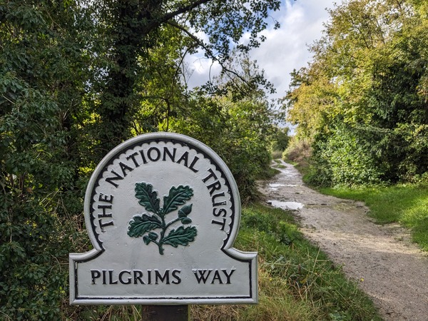
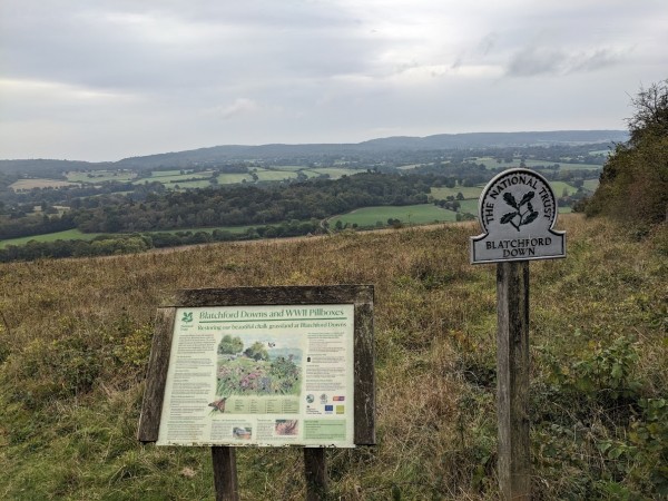
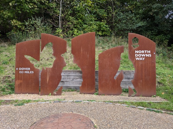
Getting onto the Downs was very easy. It was just at the end of the road. I had to keep cutting across until I came to a wide track like a racecourse. I think that was the main North Downs Way. But what I soon learned was that, unlike the St Swithun’s Way, which is the same as the Pilgrims’ Way, the North Downs Way is quite different and there are no markers for the Pilgrims Way. So I had to follow the walking guide more precisely.

My first target was the Church of Saint Martha on the Hill. It’s covered by trees and wasn’t visible, so I asked a couple of young ladies for directions. They said they were going that way, so I followed them. Because of my leg, they got ahead of me quite quickly. I followed in the same general direction, asking again and again just to make sure I was on the right way.

I saw a lot of young people coming out from a campsite with big packs on their backs. I saw them again at the St. Martha’s Church. They were being sent out on what looked like different orienteering assignments by their teacher.
St Martha
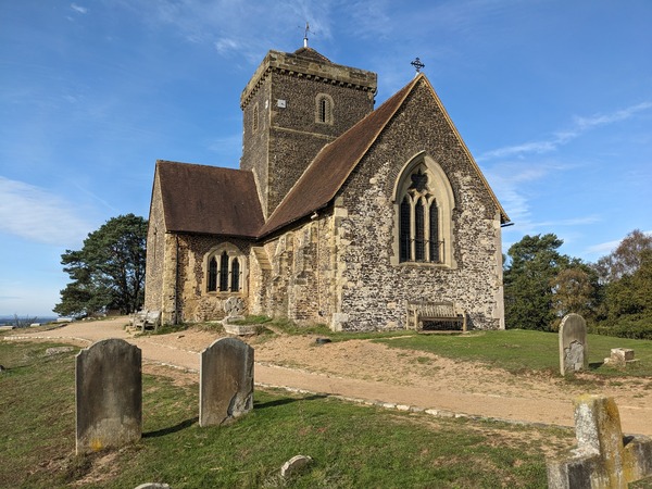
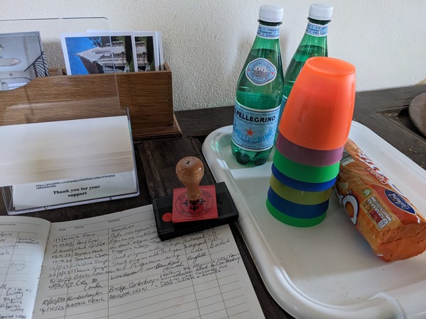
The doors to St. Martha’s were closed, so there was no way of getting a stamp. I asked two ladies sitting on a bench if they would mind signing my card, and they were very happy to do that. I’m not sure if the pilgrim verification process will worry about that. I’ve got a squiggle instead of a stamp.

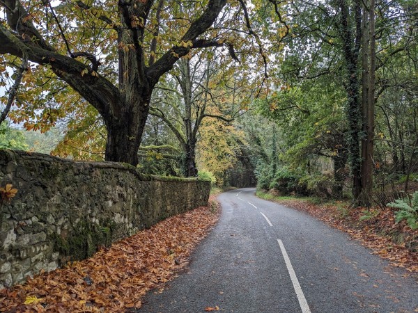
From there, I headed along sandy paths on a lovely sunny morning. It started off being the same as the North Downs Walk, and then diverged.

At one point, I met a man sitting on a tree trunk. He had dark glasses and a really stout walking stave. He said that as a result of diabetes, he had lost some eyesight and balance. So he needed the glasses and the stave. He was very interested in the Pilgrims’ Way because he was a real fan of Pilgrim’s Progress.

He was a committed Christian, and he had lots of Bible verses to quote at me. We had an interesting discussion about our individual faith journeys. Two other men came along, and for a while, we talked about steam trains, but when they were gone, he got back onto Jesus again before parting.

He told the story of the men going to Emmaus and seeing Jesus on the way and how they hadn’t realised it was Jesus at first. My thought was, had I been talking to Jesus there with his dark glasses and large stave and the spaniel dog?

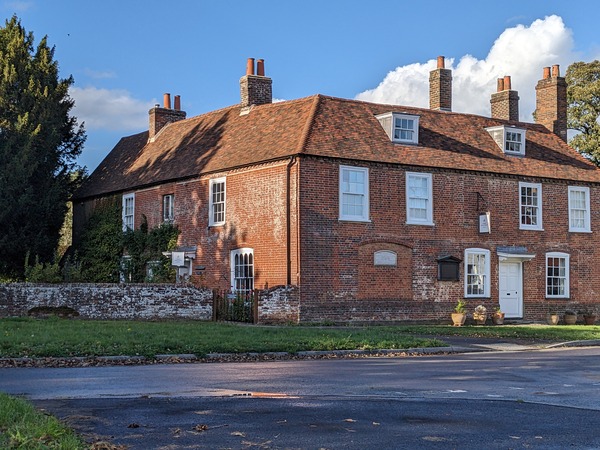
After that, there were various little turns. I came across a church that looked really splendid. I think it was called Aubrey Park Church, but there was no way into it. They had a big private sign. I think it’s more part of the housing estate than a church now.

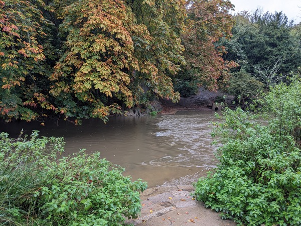
I followed the path to the village of Shere. It seemed very quiet at first, as I walked over a ford and along by the river, and then by a top-heavy building called Old Prison House, but then a bit further on, there were benches by the river and people crammed on each bench and lots of people walking around to the shops. Quite a contrast to the rest of the Pilgrim’s Way. I had found Vanity Fair. It was a tourist honey trap, and I found out later the reason was that it had been the scene for various films including Four Weddings and a Funeral.

Scallops

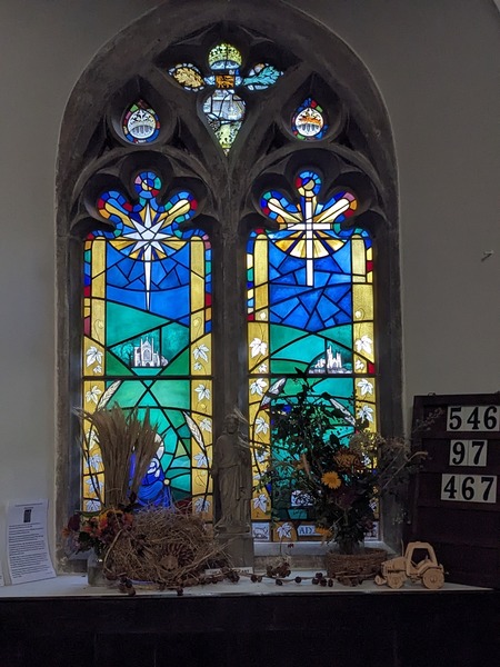
I went to the church in search of a pilgrim stamp. A lady in a red robe said, “Are you looking for the pilgrim things? They’re over this side.” There was quite a big display of scallop shells, including one large Rafia scallop shell. I couldn’t talk to her too long, but she’d been on the Pilgrim’s Way herself and had stayed in church floors on the way. That was a good way of doing it if you’re going on a budget. I think being part of the C of E herself probably helped.

Then a group of school children came, and she had to give them some sort of lesson about churches. In one little alcove, behind some glass, there was a Madonna and child from around 1300 that could have been from a pilgrim staff. It was found by a girl around 1886, given to the church in 1956, and was stolen in 1971. Thankfully, the police recovered it in 1973 from some sort of thief’s hoard, and since then, it has been kept under much tighter security.

After leaving Shere, the path I was following took many twists and turns, and I made a wrong turn, ending up on a rabbit warren path rather than the intended route. Upon retracing my steps, I eventually reached Abinger Hammer.
Abinger
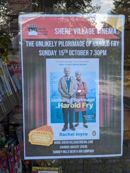
I heard the clock strike three o’clock, but I wasn’t there to witness the animatronic man striking the bell. I headed to the Abinger Tea Room to get my card signed and enjoyed a delicious carrot cake and pot of tea. I had a lovely chat with the lady there, who has been working there for 40 years. She still has her old Kent Road accent, reflecting her origins. I was the only customer, unlike in Shere. I noticed an advertisement in the window for the film ‘The Unlikely Pilgrimage of Harold Fry,’ which was shown at the Shere Village Cinema on October 15th.

I then ventured down to the farm, where they still cultivate watercress, but not in the quantities they did back in the 1970s when I used to visit. They now primarily sell it to local restaurants. I strolled around the green, and while looking across the stream, I spotted a kingfisher. It was the closest I’ve ever been to one. It was perched on an alder, but before I could even consider taking a picture, it flew away.

I then headed to catch the bus, which was scheduled for 4:17 but arrived considerably later. I had been waiting since 4 o’clock, but I didn’t mind as I was enjoying the view and the sunshine. When the clock struck 4, I thought I’d capture a video, but while fiddling with the phone camera, I missed seeing it with my eyes for a second time.

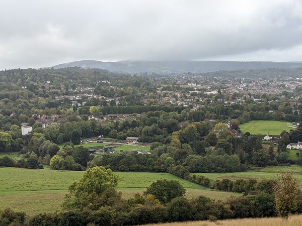
The traffic in Guildford was horrendous. The narrow valley causes traffic to funnel, leading to congestion in an Abingdon like way, probably worse. There was a mix-up with my rebooking with G at last night’s accommodation, but she found me an alternative place to stay. So here I am, in another part of town with V, who was kind enough to let me stay. She helps G out when there are foreign students need placing.

The leg held out well with my slow walking, support bandage, and walking stick. I think its probably arthritis now but can’t be sure.

Day 3 on the Pilgrims Way

After a day of rest to aid my knee recovery, I cautiously resumed the Pilgrims Way, armed with a makeshift walking stick. I boarded an early bus to Upper Froyle, near Alton, near where I had left off the previous day.
Pilgrims Way window
My first stop was the church in Upper Froyle, where I was greeted by the melodies from the organ. The church’s interior was adorned with vibrant stained glass windows and statues. A harvest display added to the charm. In the visitor’s book, I noticed an entry from a fellow pilgrim from Australia, who had also appreciated the organist’s music two days beforehand. The church also had a modern Pilgrim’s Way window showing Winchester and Canterbury Cathedrals.

Leaving the church, I meandered along a footpath that led to a long, tree-lined driveway, with a grand manor house behind. The path eventually opened into a field where some sort of excavation was underway.

The path continued towards a large house called Pax Hill, once the residence of Baden-Powell, the founder of the Scout movement. Now a care home for the elderly, it had a bicycle adorned with autumnal flowers outside.

From Pax Hill, I followed a path that the guidebook identified as part of the original Pilgrim’s Way. It led to a wide-open field covered in a shoots of winter wheat. Walking slowly, aided by my stick, I found myself immersed in the present moment.
Yew trees
The path eventually arrived at the village of Bentley. With its narrow, winding lanes, I reached the village church, where ancient yew trees formed an archway. Inside, I sat quietly on a pew, enjoying the quiet.

Concerned about my knee and not thinking I could manage 11 miles, I decided to take a bus to Farnham. There, I walked back to the point where the Pilgrim’s Way entered the town and then headed towards Farnham Castle.

The castle, now under the care of English Heritage, was an impressive sight. I wandered around, admiring the ancient walls and trying to imagine its past glory. It had been a residence and fortress for the Bishop of Winchester.

Descending into Farnham town, I visited the church and then the town council’s information center, where I requested a stamp for my pilgrim’s passport. They obliged with an old-fashioned, chunky stamp, noting that I was the first person to ask for such a stamp. The lady told me that Farnham is in Surrey but is surrounded by Hampshire on three side. I asked if that is why they needed a castle.
Start of North Downs Way
Crossing a dual carriageway, I reached the next section of the Pilgrim’s Way, which is the start of the North Downs Way. A large sculpture marked the starting point. I walked for about a mile along the River Wey, but my knee started to twinge, so I decided to turn back.

At the bus stop, I saw Richard W, a former colleague, with his grandchild and family. I think he still lives near Abingdon so was surprised. I couldn’t greet him properly due to the crowd.

Back in Guildford, I bought a proper walking stick from Mountain Warehouse and also got a support bandage for my knee, hoping to protect it tomorrow. My B&B was booked before I knew of the days rest and is in Guildford so it will be easier to walk from here and return to Farnham later. I hope I don’t get too many sections need walking out of sequence.

Day 2 on the Pilgrims Way

I began the day with a full English breakfast. Then planned to catch the bus to rejoin the Pilgrim’s Way at Bishop Sutton.

While I was waiting, I explored St. John’s church, which is right behind my room. I had heard its bells ringing the night before, so I was curious to see it. It was lovely, with stained glass windows and interactive exhibits. It even had a stamp for my passport.

Pellegrino Water
I took the bus to Bishop Sutton and immediately visited another church. It looked old. Inside, there was a table for pilgrims with two bottles of Pellegrino sparkling water and some biscuits in a tin. I saw in the visitors’ book that someone named Kimbo Hoyton had been doing the pilgrimage just four days ahead of me.

I found out there was a carol called “Bethlehem Down” written by someone from that church who was buried in the churchyard. I listened to it on YouTube. Lovely!

A man came into the church to change the hymn numbers. He had a greyhound with him, and he commented on all the Harvest decorations that had been left around the church.

Ford and cows
From there, I walked down a little road, crossing a footbridge next to a ford with cattle watching. I continued cutting across the countryside on footpaths. At some stage, the footpath ended, and I had to go down a little road where I met two men who were looking for a place called “East Tiddly” or something similar. They had instruction sheets and Google Maps, but were completely lost.

They asked if I knew the way, and I showed them the map I had in my guidebook, but it only showed the Pilgrim’s Way and a little bit either side. At the time, I was also looking for a stile that the book said was difficult to find.

We walked in the same direction for a little while, and then I found the stile. I told them I was going that way. They weren’t sure whether to follow, but as I walked across the field, I saw that they followed some way behind me.

I arrived in Ropley and bought an orange and a banana at the village shop. People were sitting outside enjoying the sunshine. One lady came up to me when she saw me reading my Pilgrim’s Way guidebook and wished me the best of luck for the walk.

The church in Ropley had burned down in 2014, but got a new roof in 2022. Inside, it was restyled and reopened, but still has the original Norman walls. There was a historical event going on with different historical societies and people coming along to look at them and listen to talks.

Turnips

After leaving, there was a little bit of rain. I crossed through a large field full of sheep and then a grassy field. Then I had to cut through the middle of a field with a tiny track through lots of enormous turnips.

After that, I came to a wood. The guidebook suggested taking the main path, but the way I went in didn’t seem to have any main path. So, I went back a bit and found a way that did seem to have a more main path.

I walked through under the trees, past a tree that some children had decorated with little doors, painted stones, and a sign that said “Be kind.” After that, I came to a crossroads and saw a Saint Swithun’s Way marker pointing straight on.

Out of the wood, I came out into the sunshine and could see a rainbow. I thought it was a good sign for the walk.

For a while I walked wide grassy paths. These were followed by narrow fenced-in paths until I came out near a garden center.

My left knee had been hurting quite a bit, and I was a bit worried about what might happen if I pushed myself too hard, so I decided to hop on a bus for a mile or so.

I got off at Chawton, but after getting off, my knee started hurting really badly, and I was hobbling. I could hardly walk.

Jane Austen's House
I tried to walk to the church but needed to rest and then turned back.  I sat across from Jane Austen’s old house, now a museum, and watched the last visitors leave. I’d wanted to do the Pilgrims Way for a long time and was only 2 days into the walk. I could not walk to Alton as planned but hobbled back to the bus stop. I will rest tomorrow, Sunday, and see how I feel on Monday.

Day 1 on the Pilgrims’ Way

Pilgrims Passport
I started my journey in Winchester, where I picked up a Pilgrim’s passport at the cathedral. I received free admission to the cathedral as a pilgrim.

Inside the cathedral, I was struck by the monument near the former shrine to Saint Swithun, which had a tapestry of a leaves birds and raindrops on one side and a beaming sun landscape on the other. I think this is a fitting start for the Pilgrims’ Way, which is a journey in all weathers through the beauty of nature.

I left the cathedral and set out through some town streets before coming across the ruins of Hyde Abbey. Like Abingdon Abbey there is still a gatehouse. I also passed by a pub called the King Alfred, where I could have got my first passport stamp, but I didn’t realise it at the time.

I continued on my way, following a path by a stream. I stopped to study my guidebook on a bench, and then I walked on and realised after a couple of minutes that I had lost both guidebook and passport. I hurried back to find it on the bench.

After that, I continued on the path and crossed under the A34 and the M3 motorway. Graffiti in the tunnel, showed lots of colourful eyes combined with colourful patterns.

The first church with a passport stamp I came to was St Mary’s Church in Kingsworthy. I made a mess of that stamp. But the church was a peaceful and welcoming place.

After leaving the church, I walked through fields that looked down on the River Itchin. The scenery was beautiful, and I was enjoying the peace and quiet.

I came to the next village, Martyr Worthy, and visited the church there. I met two other people at the church. I left my guidebook and passport again and on returning they suggested, I tie my guidebook around my neck so that I wouldn’t forget it again.

The path next took me through a field of cows. I was careful to avoid the young calves, as I didn’t want to upset the cows who I had to walk through.

The next place I came to was Itchen Abbas, where there was another church. I got my third stamp there. It had started to rain and I put on my coat under an ancient yew where the last person to be hung for stealing a horse is buried.

After leaving the church, I followed a path that crossed the River Itchin and went by Avington Park, which has a beautiful avenue of trees. By now it was raining hard.

After a few more fields and some up and down roads, I was starting to feel tired. The scenery was lovely as the path passed between the clear River Itchin and a smaller stream in which grew watercress and swans nibbled water weeds.

I knew I had gone about a mile out of my way when I came out by a church in the village of Itchin Stoke. Luckily, there was a bus from there to New Alresford where I could stay. So I went back and looked round that unusual church to pass the next fifty minutes. It was shaped and had patterned windows including a rose window at the back like a Paris church I’d once seen.

I’m looking forward to continuing my journey tomorrow. It is making sure I don’t overdo it at this early stage and get an injury.