Category Archives: The Pilgrims Way

Day 16 – The Pilgrims Way


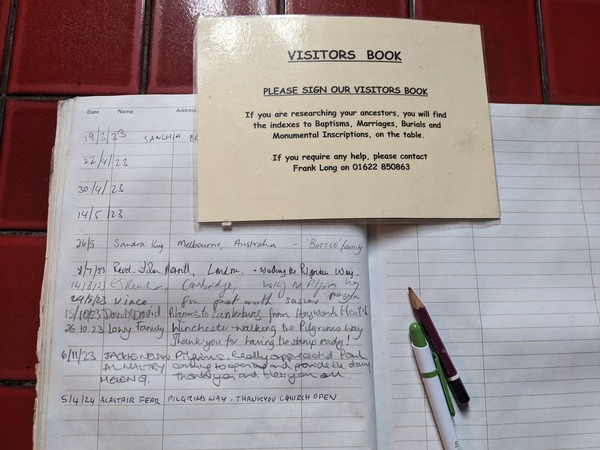
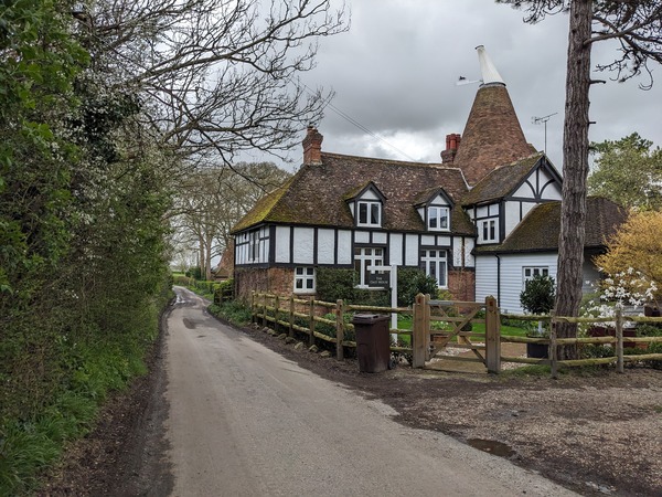
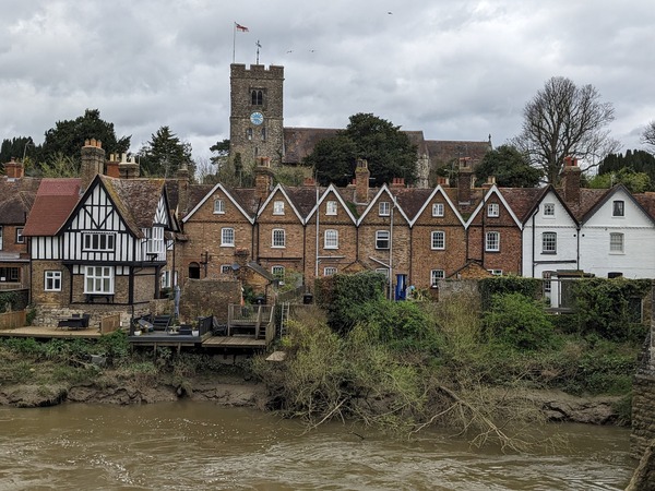
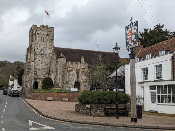
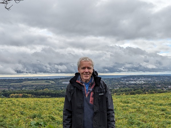
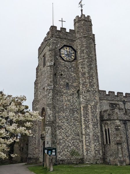
I stayed overnight at Chilham and woke early to leave at about 8 am. I tried the church doors before going and found them locked, but a man appeared and said, ‘Wait there a few minutes. I’ll open up.’ He said he did this duty on his way to pick up the papers. He told me they are getting the clock repaired by the Cumbria Clock Company, which did Big Ben, and the church has to raise £48,000. I got my passport stamped.

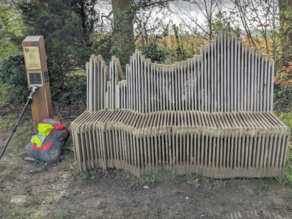
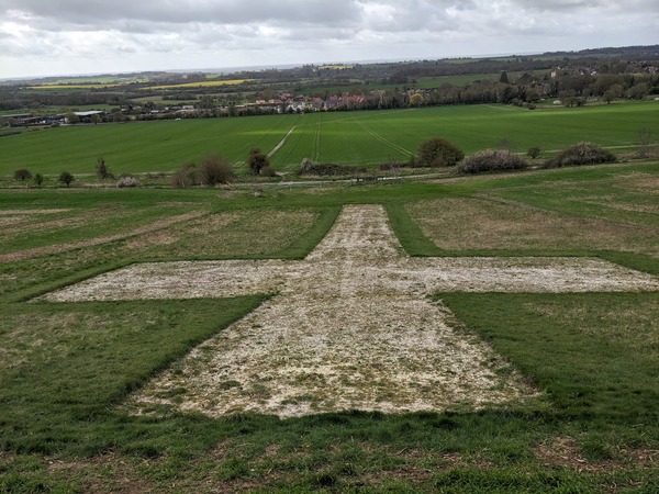
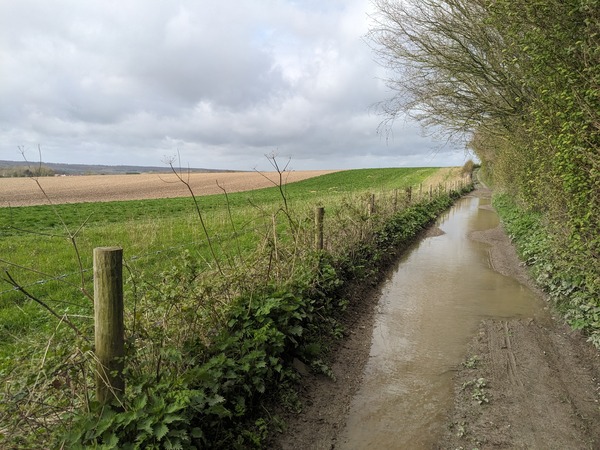
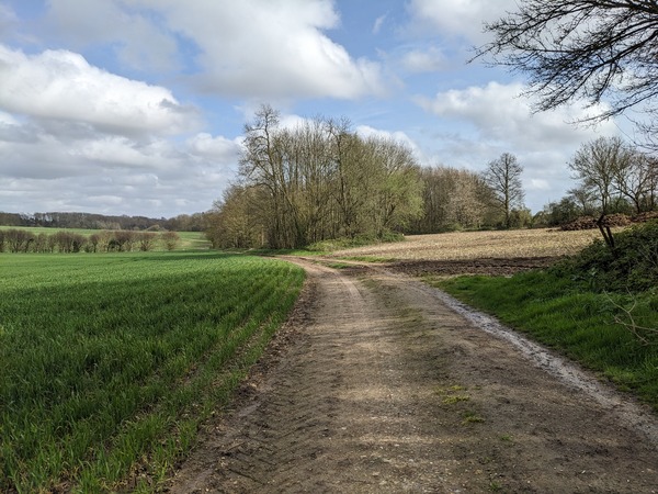
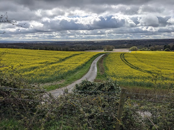
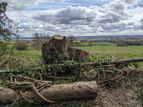
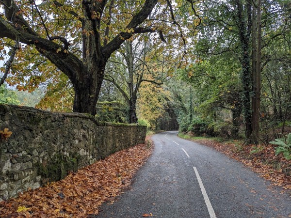
The walk was partly on roads and partly over rolling farmland. One feature at the top of what I think was called ‘Cardiac Hill’ was a seat designed to portray the sound waves of people in the nearby village. There was also an audio button for some poetry and an explanation of the artwork. The seat had a good view but I had to press my ear to hear the audio as the wind was noisy. The seat was made from apple crates. Soon after, I went through a huge orchard area with thousands of apple crates.

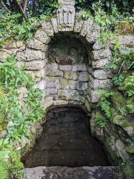
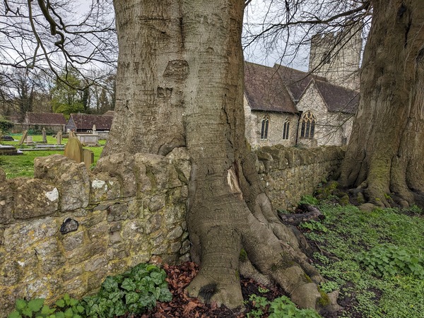
I arrived at Harbledown and tried the water from St Thomas Becket’s Well. Some of the Pilgrims who went to Canterbury in medieval times went to be healed, and perhaps the well had healing powers. I arrived at Harbledown Church just as their Sunday morning service was nearing the end. I went in to enjoy the smell of incense and the last hymn. I also got my pilgrim’s passport stamped there. They invited me to the church hall for coffee and cake, and were very friendly and sent their greetings to the churches in Abingdon.

Soon after, I got a view towards the towers of Canterbury Cathedral. I stopped off at St Dunstan’s Church on the way and admired the Thomas Moore window in the Roper Chapel. The head of Sir Thomas Moore, having been spiked over London bridge, was buried in the Roper Chapel.

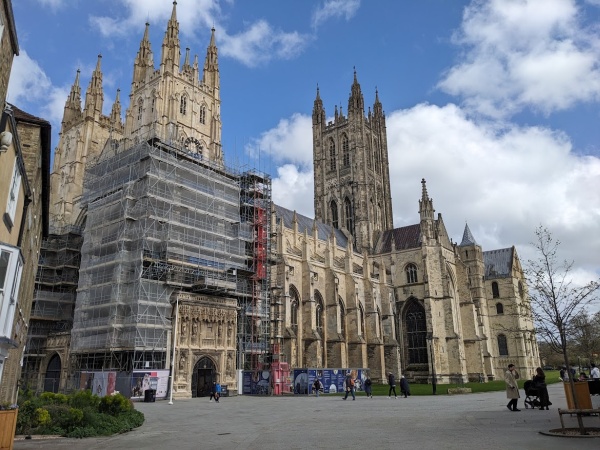
From there, the last part of the pilgrim way was through busy pedestrian streets to the cathedral where I got what I thought would be the last stamp. I was allowed in free as a result of the passport stamps.

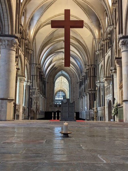
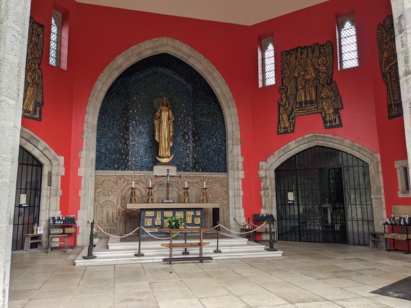
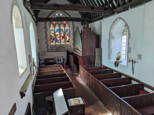
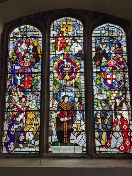
I went in search of St Thomas Becket’s shrine. But just like St Swithun’s shrine at Winchester, it had been removed under the orders of King Henry VIII. Instead there was a single candle.

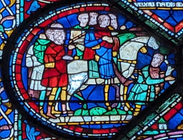
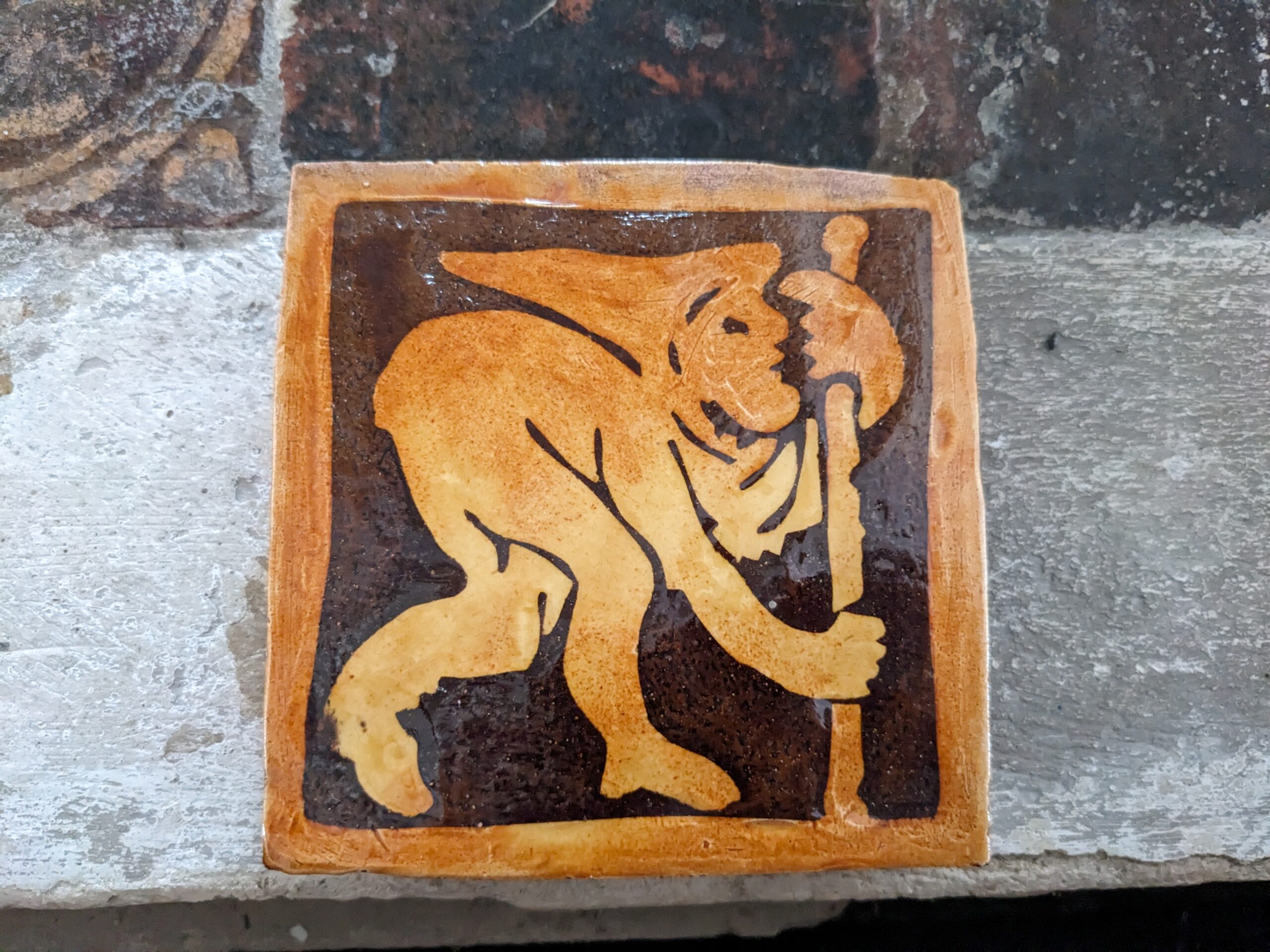
There were lots of stain glass windows showing people in beds being cured. Among them was a picture of pilgrims going to Canterbury. The man in front has crutches. I bought a little Becket badge as a souvenir like pilgrims used to do. Back then they would have been made in lead but not anymore.

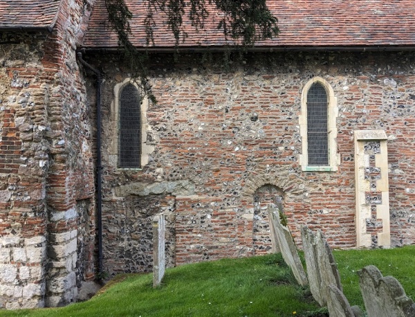
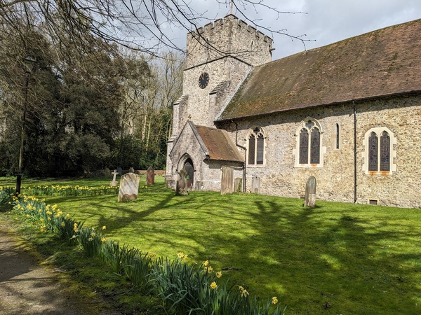
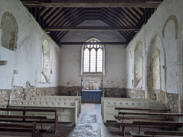
I also visited St Martin’s Church about half a mile away. It is the oldest continually used church in the English speaking world and was founded about 580 AD. I only just got there in time as they closed at 3 pm and I got there with minutes to spare. The volunteer manning the church said it was more interesting than the cathedral. He showed me the roman walls and square door from around 400 AD, from a Roman building, that form the oldest part of the church. He also stamped by passbook with a final stamp, bigger than the Cathedral stamp.

I came home by train and bus in about 4 hours. The equivalent distance took me 16 days on foot.

Day 15 – The Pilgrims Way


My final night using Maidstone as a hub
It wasn’t a place I got to know well. On the corner of High Street as I left, I saw a plaque commemorating seven people who were burned for their faith near that Spot in 1577.

Today, with the sunshine and a seat upstairs, I enjoyed a great view from the bus. It felt like sightseeing with half-timbered buildings, village greens, churches and church barns, and a forest nature reserve.

I changed at Ashford. I aimed to get from stop L to stop J at County Square, thinking they’d be close together. I had a few minutes before the 666 bus (the one I missed yesterday after getting lost). The bus driver’s instructions for stop J weren’t clear. I found stops M and N, but not J. Eventually, with someone else’s help, I located it, but by then, I’d missed the 666 again. So, just like yesterday, I ended up taking the B bus. I then walked about a mile on a busy road to find the Pilgrim’s Way at Boughton Lees.

There, I found a beautiful open church called St.Christophers. It’s an old secular building converted into a church. Window ledges on both sides held jars of flowers, creating a pleasant aroma. The door kept swinging shut due to the wind, and unfortunately, when I left and closed it, it wouldn’t open again.

Continuing the way, I followed instructions from my guide and found the path leading to Canterbury. As I walked along a narrow path, two Germans approached me going the other way. They were confused, asking if this was the way to Canterbury. I pointed them in the right direction. They were the first people with the same destination but were on the secular North Downs Way.

The path led to another church at Boughton Aluph, which was closed. I sat on the rustic seat near the yew tree before following another path that led through a farmyard.

At the top of the hill, I was about to open a gate when a group of BMX motorbikers approached from the other side. They seemed friendly, and I let them pass through.

It was soon my turn to get confused. I had to cross a large field with crops planted on the guidebook’s footpath. I backtracked and walked all the way around the field. It had high fences and I was glad to find an exit. Today the walk felt more fiddly and there was no chance of getting into a fine meditative state.

I walked for a mile or so on a narrow path by a busy road with views across the Stour river.

At Godmersham, I found another church, which was open. I stamped my continuation pass sheet. I searched for a supposed relief picture of Thomas Becket, but couldn’t find it. There was only a photograph of one, so perhaps it had been removed. However, I did see a pilgrim tile similar to the one in Canterbury (possibly a reproduction).

Next to the river, I sat for a while in the churchyard before continuing my journey. The path followed what used to be the old Canterbury Road, running alongside a country
estate with a high wall and avenue of trees.

The path then led through a high gate into the grounds of Godmersham Park, and continued along a track that became Mountain Street, eventually ending in Chilham, where I’m staying tonight. It has lovely old buildings, and a carving of pilgrims.

From my window, I can see trees with pink blossom, filling the frames, as I type this one fingered on my phone. Tomorrow will be the last day and I’ll reach Canterbury, God willing. But it is the journey I enjoy not getting there.

Day 14 – The Pilgrims Way

  • I took the 10X bus to Harrietsham this morning. The windows were grimy with rain, so it was difficult to tell where we were, but with the help of Google Maps, I got off at the right stop, Church Lane. And I walked up to the church.

Four or five people were cutting the grass. I found that the church door was open, so I went in and had a look around. No pilgrims stamp. There wasn’t even a visitor’s book at first glance. The donation device was not attached. I found lots of piled books and one of them was the visitor’s book. I pulled it out, put it on the desk, and signed it. The previous person to sign had been in 2023. On leaving the church, a man with a clipboard said, ‘Oh, you’ve been looking around, have you?’ And I said, ‘Yeah, just been in the church.’ And he said, ‘Oh, it’s not really open, it’s only open so the boys can use the facilities if they need.’

I decided to cut a corner to get back on the Pilgrim’s Way. Unfortunately, by doing that, I missed the statue of a monk on a seat, called ‘Pilgrim Resting.’

The Way was sometimes a road and other times a mud track, running along the hillside. it was windy, and I came to a place they’d planted 2000 trees for the Millennium. The trees provided good shelter and made the wind more atmospheric.

Above Lenham, a chalk cross was carved into the hillside. It had been done in 1922 as a war memorial for Lenham.

I carried on walking, and had lunch when I felt hungry. A ferret like animal, brown with white face, drank from a puddle. I had some olives, which again fell over in the bag even though I’d taken precautions. So I had an oily bag again. I couldn’t find the cucumber and lettuce I thought I had in there. And I noticed someone else had left some litter around, and so I ate the olives and then was about to set off when I thought, um, maybe I should pick up the litter even if it isn’t mine. So I stabbed it with my stick and found this cucumber and lettuce inside. It was mine. I don’t know what that goes to prove.

I carried on walking, on and on and on, the sun chasing cloud shadows across the fields. I sang some choruses. I thought about the pilgrims in the past and whether they went to Canterbury because of Jesus or because of Thomas Becket. Or Both? On and on and on, sometimes being mindful and aware of the Spring, at other times daydreaming.

I passed a few people. There was a lady coming the other way just after I’d been through a particularly flooded bit and I said, ‘It’s a bit muddy there,’ and she said, pointing behind her, ‘And there’. I saw a young lady leading a Shetland pony. Then a man with a dog carrying a poo bag who laughed when I said hello, and then two young men overtook me running. They skated about over the mud as they ran by.

I decided not to go down to Charing, because it was quite a long walk today. 11 miles minimum, and I didn’t want too many diversions. But my legs weren’t feeling too bad. Sun was out some of the time and it was windy all of the time.

Only at Westwell, did I decide to cut down to the village, down a footpath through young leafy crops. The church had a steeple; most of them have towers. And it was open and had a stamp, so I put the first stamp on my overflow card.

From that church, I remember the floral Millennium window. And a slogan on a banner, ‘Love God, Serve Community, Grow Church’. They had an Alpha course and trip hazards, several extension leads.

Having returned up the hill, I took a while to be sure about the route. When I found the way, there were some lovely rolling green fields. Then a ruined church and a large lake.

At the lake, I saw these two women with their two children, throwing in a big weight on a string, fishing? The children smiled at me. There was a big sign, ‘Private no fishing.’

I then didn’t look at my guidebook properly, went the wrong way round the lake and added another mile or so to the route.

So I ended the day confused and flustered and I got a bus that went through most of the estates in Ashford before getting to Ashford International Station where I caught the train for Maidstone. The stations now all had memories from the Pilgrim’s Way. It was interesting to see the Lenham white cross from a distance.


Day 13 – The Pilgrims Way

There were four churches on the route today. The first was at Boxley. When I went in through the front door, I found myself in a tiny Norman church that has been turned into a porch. They had refreshments for pilgrims. The main church had lots of flower decorations after Easter. It also had “HOPE” written in huge letters at the front.

Although, the Pilgrims’ Way continued as a small road, my guidebook took me along parallel footpaths for the first part of the day. Round the churchyard where there was a tree growing into the wall. Then, through some trees where I was overtaken by two boys and their mum, all hand in hand. One of the boys said, “I hope you’re having a nice walk,” very politely. They left me behind because they were going faster. Also the route directions were not straightforward and I kept rechecking.


The first obstacle was a dual carriage way. I climbed some steps up to it, then walked along and came to a footbridge with a picture of a dancer on the side. A girl of 9 called Jade and her grandma were killed there in the year 2000. There had been two previous deaths of elderly people there. So, the community clubbed together and built the bridge.

The bridge took me to Detling whose church was closed. I carried on from there along a narrow path. When it opened up, I found myself crossing two large fields planted with new vines with protective plastic sheaths. Skylarks twittered over my head.

Then, I came to the next church in Thurnham. Also closed. So no stamp. But a lovely display of daffodils beside the path.

After another footpath and a picturesque double oast house, I rejoined the Pilgrims’ Way. It meandered from side to side, and rolled up and down. The hedgerows were fresh with Spring flowers: dandelions mostly, but also white and red dead-nettle, celandine, wild garlic, and shepherd’s purse. Bumblebees hovered about. The hedges were coming into leaf or blossom. And there was lots of birdsong. Not many cars either. So not bad.

I walked on and on without any change of route until I got to Hollingbourne where there was another oast house. Someone congratulated me on the walk and asked how I was getting on.

The church was open, and I got a stamp to complete my passport of 24 stamps. I’ll need a continuation sheet now as there’s no room left for Canterbury Cathedral.

My leg felt a bit better today but I thought I wouldn’t push it too much. Also I saw there was a bus going back to Maidstone in about a quarter of an hour. So, I sat on a seat and took off my plastic trousers and my support bandages. The bus went through Leeds. Not Leeds, Yorkshire, but Leeds of Leeds Castle.

Day 12 – The Pilgrim’s Way

Today’s walk was unlike any other on the Pilgrim’s Way. It began at a promontory over the winding River Medway. Across the river, was a sandy / muddy shore with reeds. Beside me, a long flight of steps led down to where there was once a ferry.

A large new bridge over the Medway took me to Peter’s Village. The village wasn’t in my outdated 2018 guidebook, and a lot of new housing had sprung up along the riverbank. Unsure if the route had changed significantly, I pressed on.

Consulting Google Maps, I discovered another version of the Pilgrim’s Way which seemed to cross the river at nearby Snodland where there used to be another ferry. My guidebook offered one version, perhaps the revised standard version, while the original authorised version was no longer possible.

I left a road to take a bridleway that looked correct. Unfortunately, the path beyond was blocked by a large pile of dumped asbestos in two spots, taking up most of the width.

Moving past that obstacle, I soon came upon a deserted church called St Mary’s at Burham. The village moved and when they built a new church further up, this one was closed. Surprisingly, it was open for visitors and well-maintained by volunteers. The interior was whitewashed with plain glass windows. Although services are no longer held here, it had a peaceful puritan atmosphere. Floor memorials from the 1700s were still in an unworn condition.

Feeling the urge to embrace the pilgrim spirit, I started singing ‘To be a Pilgrim.’ But upon hearing voices, I stopped. The voices came from people working nearby, not within the churchyard itself. So much for being valiant!!!

Following the paved and sometimes flooded bridleway, I walked past farmland on one side. The other side offered a curious mix of landscapes – horse pasture, an industrial area with a chemical plant, a solar farm and giant battery facility, and a water treatment works. For stretches, the land was flooded and it seemed the river was near, but I wouldn’t see the Medway again until I reached Aylesford.

Before Aylesford, I came across Aylesford Priory. It houses a priory and a handful of friars, with plenty of accommodation for retreats, conferences, and even the occasional funeral (which I witnessed on my way out). The priory has a large alter area, half indoors and half outdoors, with numerous outdoor benches that could seat large crowds for mass.

Inside a priory chapel, I lit a three day candle for £5. Dedicated to my mum after her recent 90th birthday. She is a Carmelite like the priory.

The priory has a long peace garden with flowers on both sides and tiles with the word “peace” written in hundreds of languages. Following that, I explored the rosary garden with some impressive pottery Stations of the Cross.

After collecting a pilgrims stamp at the reception, I crossed an ancient bridge over the Medway (no longer used for traffic) and took a picture of the picturesque town.

The train station turned out to be another three-quarters to a mile away and I was limping. My Achilles was quite sore, but with some rest, I’m hopeful for another walk tomorrow.

Day 11 – The Pilgrim’s Way

I caught a train and bus to get back to Wrotham where I left off yesterday. While waiting at the station, I heard an announcement about a train strike on the day I planned to return home. This means I need to adjust my schedule.

The bus was late, and people around me mentioned these buses didn’t always turn up due to staffing issues. Thankfully, it arrived about ten minutes behind schedule.

The path initially crossed the M20 motorway. Thankfully, my single lane road, still called Pilgrim’s Way, was not near the M20 for long. Here, rapeseed was in flower in some fields. A footpath paralleled the lane and had a good view across the Medway valley, and up into the hills. I spotted some goldfinches flitting about and after a couple of miles sat down and soaked up the sun (and snacked on some open olives and tomato before they made a mess of my haversack.)

As I continued, the road became a muddy track through a woodland area. There, I encountered a rather unpleasant sight – a fox carcass crawling with bluebottles. The smell was sweet and strong. The bluebottles took off like the spine evaporating

Reaching a point where a church was visible, I considered stopping for a visit. Although it was a half-mile detour, I decided to go for it. The path leading down was a change from the hedged tracks I’d been following most of the day. This section felt more open.

Upon reaching the church, I saw a couple of men cutting the grass. I tried the door, but it seemed stuck. Disappointed, I was about to head back when I remembered a mention of a famous person buried in the churchyard according to my guidebook. Determined to find something for my half mile detour, I ask one of the men. He kindly pointed me towards the grave hidden beneath a yew tree. He said it used to be even more concealed! It was the grave of the artist, Graham Sutherland, who lived nearby.

I gave the church door another try, and this time, it opened! The interior was quite amazing, boasting a high pulpit with a crown-like structure above it. I discovered this pulpit had been in Westminster Abbey for some years before being relocated here. The old-fashioned pews with opening and closing doors added interest. They even sold Pilgrim’s jam at the back (although I couldn’t take any with me).

Following the tradition mentioned on a brass plaque by the door, I offered a prayer for the church and its minister before leaving. I got a stamp in my passport. What a turnaround from a seemingly closed church!

The path continued with another climb across a ploughed field to a lane. There, a postbox – elaborately decorated with yarn for Easter – was being examined by a dad and three youngsters. I didn’t see many people on the path.

Back on the track, I reached White Horse Wood. While the picture in my guidebook showed a path with a beautiful arch of trees in full leaf, it wasn’t quite as complete yet. Worse was to come with the sight of chopped timber throughout the area. A sign explained it was due to Ash dieback disease. It is a real heartbreaker. Seeing all those fallen trees. Ash trees would have been there for medieval pilgrims, and now they are gone.

The cleared trees provided easier glimpses across the Medway valley as I continued. Finally, I reached the town of Upper Halling, perched on a white cliff. The descent to Lower Halling was next to a fenced off quarry. I got the train from there back to Maidstone.

Day 10 – The Pilgrim’s Way

I’m back on the Pilgrim’s Way. I took a break back in November, and restarted the journey today, on the first of April, which also happens to be Easter Monday. I restarted from Otford, which is near where I ended last time, and ended today at Wrotham.

Today, I walked about ten miles, with only six miles being on the Pilgrim’s Way itself. I had to walk to and from the Pilgrim’s Way.

Otford has a traffic roundabout with a duck pond in the middle, surrounded by a green verge. They have some big ducks, and there’s a duck house in the middle. Unfortunately, both the church and Sally’s Cake Emporium were closed, which were the two places I hoped to get a passport stamp for restarting the pilgrimage.

Leaving Otford, I got onto a road called Pilgrim’s Way East, where the North Downs Way separates after a short while. The road had no pavements and was fairly busy with cars, so I put on a hi-vis jacket for safety. After a couple of miles, I reached the village of Kemsing and took a diversion to see a lovely church with a wooden rood screen and bright alter. I left my name in the visitor’s book and got a passport stamp, and saw there’s someone else walking the way ahead of me.

The sun came out, and I sat on a bench and enjoyed the churchyard, with bird song and a tree snowy with blossom, despite traffic noise from a major road not far away.

From there, I took a footpath that led me back to the road, now called Pilgrims Way, which had become single track and was less busy.

It started raining, and my bag got wet, which seeped onto the book I’m reading, but it wasn’t too serious. The road vered off to the right and the Pilgrims Way then followed the North Downs Way ahead. I passed a couple of horses and then a family pushing a buggy, but it was very muddy. The family joked they regretted not bringing their off-road buggy.

I left the way at Wrotham, where I visited St. George’s church, which had a flag flying over the tower, a castle-like tower. Inside were lots of memorial brasses on the flagstones and a large Easter Garden display with figures. A man came to close the church and said that I was lucky to find it open because if it hadn’t been raining, he would have closed it earlier.

After that, I walked a mile or so to the station to catch a train to Maidstone, where I’m staying. Maidstone is a good hub as I can easily reach other places, and it’s fairly cheap. Overall, it was a good day despite feeling a bit sore in my ankle and knee. I met some friendly people, particularly in Wrotham.

Day 9 – The Pilgrims Way

PiIgrims Way on Road
Today was a day out of sequence. I missed the Farnham to Guildford section earlier because of my knee injury. So today, I drove down to Farnham, very early. It was raining, and I left the car all day in a car park and started walking from the beginning of the North Down’s Walk. I followed the path alongside the River Wey, and then went on a road that crossed the River Wey by a stone bridge at Compton.

From there, the path entered the Runfold woods, which had been severely affected by the winds in 1987 and 1990. It’s no longer a Beechwood but has become more varied and is managed for wildlife. I emerged onto a road near a school. This road was long and straight for some miles, following the path of the original Pilgrim’s Way, while the North Downs Way followed footpaths.

There were separate footpaths along the road that alternated from one side to the other through to the village of Seale. I took a break and sat on a bench at a crossroads called Sandy Cross, looking north and east and west. There was not much traffic as I sipped water and ate a banana. There weren’t many people around either. Then, I carried on to the centre of Seale where I found a church.
Seale Church
I went around to the south porch and found that the door was open, allowing me access to the dark interior. There was a pilgrim stamp, which I used to fill the missing space I had left in my passport. Inside, I noticed a window dedicated to Anna and Simeon, two elderly people waiting for Jesus, which struck me as different, their wrinkled faces like mine.

As I left the church, the weather was improving. It had been raining when I began my journey. I had a lovely view across a field with some cows and up the hills towards the Hog’s Back. The war memorial had wooden crosses made dark by weathering, but the poppy wreathes remained red. I continued along the road, which wound left and right and lacked a separate footpath, so I had to cross sides several times. Most of the traffic was in a hurry which made it a bit challenging.

The surroundings woodland had orange bracken. At one point, I noticed a sign for the North Down Walk, but my path passed another Pilgrim Cottage, unique in it’s village but not along the Pilgrim’s Way. I reached Puttenham, where there were hop fields with poles. The hops had been harvested, and a few stragglers clung to poles.

I continued down a narrow street in Puttenham, which was constricted by ongoing roadworks. Along the way, I saw several straw figures as part of a scarecrow display. The pub was called “Good Intentions,” and featured a figure in puritan dress kneeling with a sword.

After that, I reached the church, which had a sign for an Alpha Course. The church itself was old, as my guidebook suggested, with a nave and an entrance dating back to early pilgrim days. The church was bright and well-lit, and there was a bookstore at the back. Outside I sat on a bench and ate my two oranges and looked at an old well and over rooftops, some of which had the vented hop chimneys. The village appeared in Brave New World by Aldous Huxley: ‘Puttenham was a modest little village nine stories high, with silos, a poultry farm, and a small vitamin-D factory.’
Crosses over Pilgrim's Way
I continued from there, and the path led through Puttenham Golf Course, where golfers were playing on either side. Signs for Tee Ten kept appearing until I passed Tee ten. The path went under a larger road, and then under a smaller road, with wood crosses on either side facing the Pilgrims Way.

Eventually, I came to another road at Compton, where I made a wrong turn, as I should have gone left towards Watts Art Gallery. Instead, I went straight across and found a narrow footpath that led to an area where young women were riding horses and practicing over horse jumps.

I realised I had made a mistake when I looked at Google Maps, so I retraced my steps and found the North Downs Way. I met a fellow walker who had come from London for the day and was doing a section of the North Downs Way. We walked together for about a mile, enjoying the sandy path, which was quite easy to walk on. He had an app that beeped if he strayed from the path.

At a junction, I had to continue straight on the road while my fellow walker followed the North Downs Way footpath to the left. My road went by a care home called Pilgrims Wood, and a Pilgrim’s Gardens, and another Pilgrims Cottage.
St Catherine's Chapel
The path then led me past the Surrey Police Headquarters and descended towards a road in Guildford. I crossed that road and continued on the path, and climbed a hillside to the ruins of a chapel called Saint Catherine’s Chapel. It is fenced off and mended in places with sharp edged modern stones.
Reflections in the River Wey
The path continued downhill to the River Wey, and I followed the riverway to central Guildford to catch my bus back to Farnham. There were beautiful reflections on the water of the far bank, with the sun behind me.

By mistake, I took the slow bus back to Farnham, with its 61 stops. It felt like another pilgrimage. The driver was one of the friendliest I had ever heard. He greeted everybody with ‘how are you today’, and then as people got off, he said, ‘Have a good rest of the day’ or later on, ‘have a good evening.’

Day 8 on the Pilgrims Way

The day began with a scramble up a bank to get to the footbridge over the A22 and re-join the way. Getting there had been quite difficult as I returned to Godstone and crossed the roads, making up the M25 and A22 roundabout. I’d seen a dead deer by the roadside. Then, there was no easy way up to the footbridge, so I ended up holding on to ivy and scrambled up the bank.

Today’s Pilgrim’s Way followed the North Downs Way (NDW) at first.

Early on, I came close to a large stag with antlers, that strode away and was gone.

After the way diverged from the NDW, I walked on enjoying the scenery but soon found the instructions no longer matched what I was seeing. I saw about twenty deer that all decided to run away together. I clambered through a fence and, using google maps, found that I could re-join the NDW up the road.

The Pilgrim’s Way and NDW went together for a mile or so, and climbed to a view across the M25 valley.

To rest my knee, I sat on a bench. Then looked for my water bottle but it was gone, probably during the scramble up the bank. I had nothing to drink. But there was a light rain. The path went down below a quarry, and then climbed up a chalk path running with water. I wasn’t going to die of thirst and knocked raindrops from haws and rosehips to get some water from finger tips to mouth. I tried a mouthful from a cattle trough – not a good idea because the water though clear had lots of leaves at the bottom. I even walked along with my mouth open to the rain.

The chalk path led to the highest point of the whole walk, round the enclosed Titsey Place and its park. Then the path left the NDW and went down beside a field with lots of pheasants who ran away or took flight as I approached.

The next stop was Titsey Church. I was quite lucky that it was open since it is only open a few hours a week and should not have been open in October. There were no books of any sort inside so it was not a used church. There were pews, a pulpit, and font, and stain glass windows. In a side chapel was a beautiful marble lady and a elderly bearded gentleman, one on either side, reclining . I signed the damp visitors book but could not see the writing of the Australian Pilgrim I usually saw ahead of me. I found the pilgrim’s stamp in the porch in a box and stamped my card. By now it was raining hard.

For the rest of the day’s walk to Westerham Hill, the Pilgrims Way followed a road called Pilgrim’s Lane. It had a little traffic, and I saw two horses, and a farm called Pilgrim’s Farm. It was also flooded in places so I walked though the water on my heels.

The first fields had lambs, and then after crossing a road there were vines. A tractor machine was harvesting the grapes. The lambs had been in Surrey and the vineyard in Kent.

I caught a bus back to Oxted and then returned home this evening. I will look for a clear run of a few days where I can do the Kent part of the Pilgrims Way.

Day 7 on the Pilgrims Way

Misty start
I took a bus back to Reigate Hill. From there, I tried to find the path back to rejoin the Pilgrims’ Way. I followed a track and even went into someone’s garden by mistake. After that I came back to the road and found a clue that led me up a steep climb and onto the correct path.

The path at the top, crossed a footbridge, leading to what’s called Gatton Park, where there’s a car park and a cafe serving breakfasts and coffees. It was misty and little could be seen from a viewing point. Gatton Park itself is a wooded area with two paths.
Stones
The paths joined and led past a millennium stone circle with a stone for every 200 years between the time Jesus was born and the millennium. Each stone had some writing from that period, beginning with John 1:1: “In the beginning was the Word, and the Word was with God.”

From there, the path led around a school, the Royal Alexandra and Albert School, a state boarding school. It also crossed a golf course where I met another walker. He said that he topped up his water bottle in churchyards where they always had a tap, and even knocked on doors for water.

I came out on Quality Street, in Merstham, which is a street that looks rather like the houses on the original Quality Street box of chocolates.

The path crossed the eight lane M25 which had warnings of congestion after the next junction. What a roar!

I went to St. Katherine’s Church and found that it was open. They had a pilgrim stamp, so that was a surprise. The church itself, until about 150 years ago, had some murals. One of them showed Thomas Becket being murdered by four knights. This suggests that it was on the original Pilgrims’ Way.

The path followed Rockshaw Road over two railways and then under the M23.
White Hill
The path then crossed a field. Looking back from that field there were some open views looking west.


The path became enclosed by trees again at the top. It came to a road with a sign for Chaldon AD 1086. Down the road is a church with a wall painting from around 1200. In the lower left quadrant where murderers are being burned, there is a pilgrim who has sold his pilgrim’s cloak to buy drink and got drunk (inset).
Pilgrims Way
The path then crossed a road I used to cycle down when I worked in Caterham. It is very steep and near the Harrow pub. Nearby is a folly tower with a cavernous hole at the bottom that didn’t look safe.

And further on I came to a very old farm. Looking north, I could see tall buildings in the distance, possibly central London – one of them might have been the shard.

It was a revelation to find views I did not remember at a place I thought I knew well. The next surprise was where the path came out at Caterham Viewpoint with a wide view south over the countryside. I sat there for a while, and even saw a buzzard.

I followed the path down towards the A22 but I got it a wrong and ended up going down the wrong steps which led to a path over the M25. It didn’t really matter because it turned out to be a shorter cut to Godstone where I could catch a bus.

I got the bus to Nutfield, my old village, and had a look around there, even came across Ken coming out of his allotment. He’s one of the few people I still know in the village. He said he’d been there 61 years. He has walked most of the Pilgrims Way but not in one go. He used to take people on walks around the village and knows every path and byway for miles around.

I then had a good meal at the Station hotel. The best Pad Thai I’d ever tasted. I asked how they had done it so quick. Answer: In a Wok.

As it would have been my dad’s birthday, I visited the memorial garden at Christchurch.